The photos of the lot are informative and indicative, and cannot provide a highly detailed view of the object from all angles. We recommend a careful physical inspection of the lot before bidding.
The photos of the lot are informative and indicative, and cannot provide a highly detailed view of the object from all angles. We recommend a careful physical inspection of the lot before bidding.
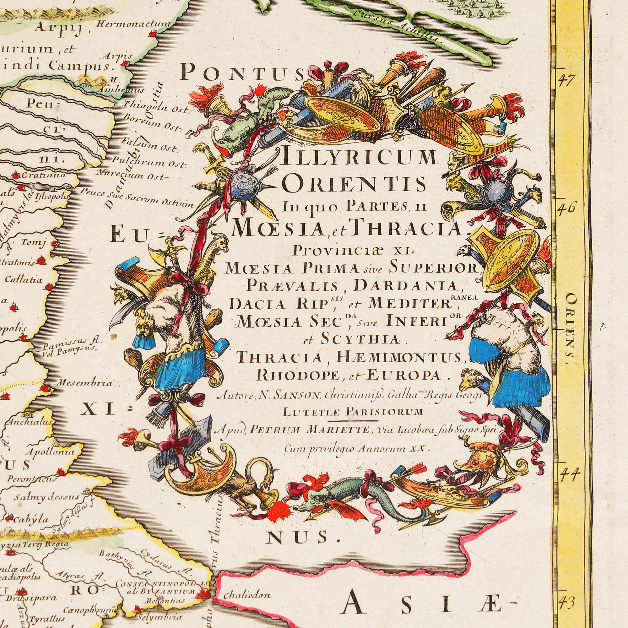
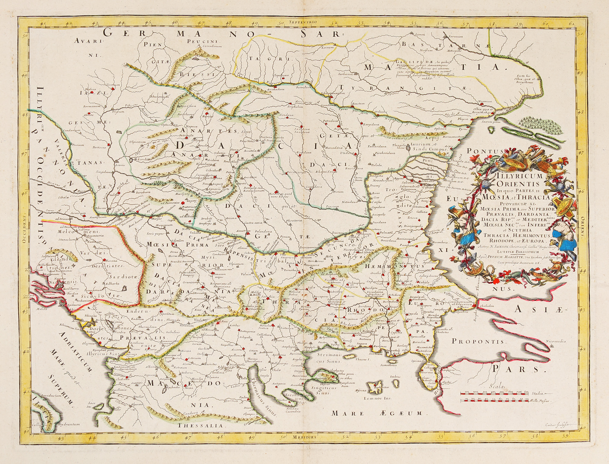
237. "Illyricum Orientis" map, by Nicolas Sanson (considered to be the father of French cartography), Padova, 1666
Starting price
Pretul de pornire si cel estimat nu sunt preturi de vanzare efective
EUR 300
Sold
Pretul de pornire si cel estimat nu sunt preturi de vanzare efective
EUR 600
Session
Tue, 19 July 2022 19:00
Brought to you by
Nicolas Sanson (1600-1667), a royal geographer, was the teacher of Louis XIII and Louis XIV, both kings of France. In 1656, he drew a view of the Timișoara fortress.
Dimensions
width 64 cm, height 55.5 cm, custom 55.5 Ã 64 cm
Description
copper engraving, hand-coloured, striped paper
ADDITIONAL INFORMATION
For clarifications regarding the bidding procedure, hammer price costs, guarantee, payment, and collection terms for the winning lot, we recommend carefully reading/re-reading the Bidding Regulations.
For additional information regarding the lot and the auction, please contact the Art Consultants Department.
Detalii
Nicolas Sanson (1600-1667), a royal geographer, was the teacher of Louis XIII and Louis XIV, both kings of France. In 1656, he drew a view of the Timișoara fortress.
ADDITIONAL INFORMATION
For clarifications regarding the bidding procedure, hammer price costs, guarantee, payment, and collection terms for the winning lot, we recommend carefully reading/re-reading the Bidding Regulations.
For additional information regarding the lot and the auction, please contact the Art Consultants Department.
Dimensions
width 64 cm, height 55.5 cm, custom 55.5 Ã 64 cm
Description
copper engraving, hand-coloured, striped paper
Brought to you by