


The photos of the lot are informative and indicative, and cannot provide a highly detailed view of the object from all angles. We recommend a careful physical inspection of the lot before bidding.
The photos of the lot are informative and indicative, and cannot provide a highly detailed view of the object from all angles. We recommend a careful physical inspection of the lot before bidding.
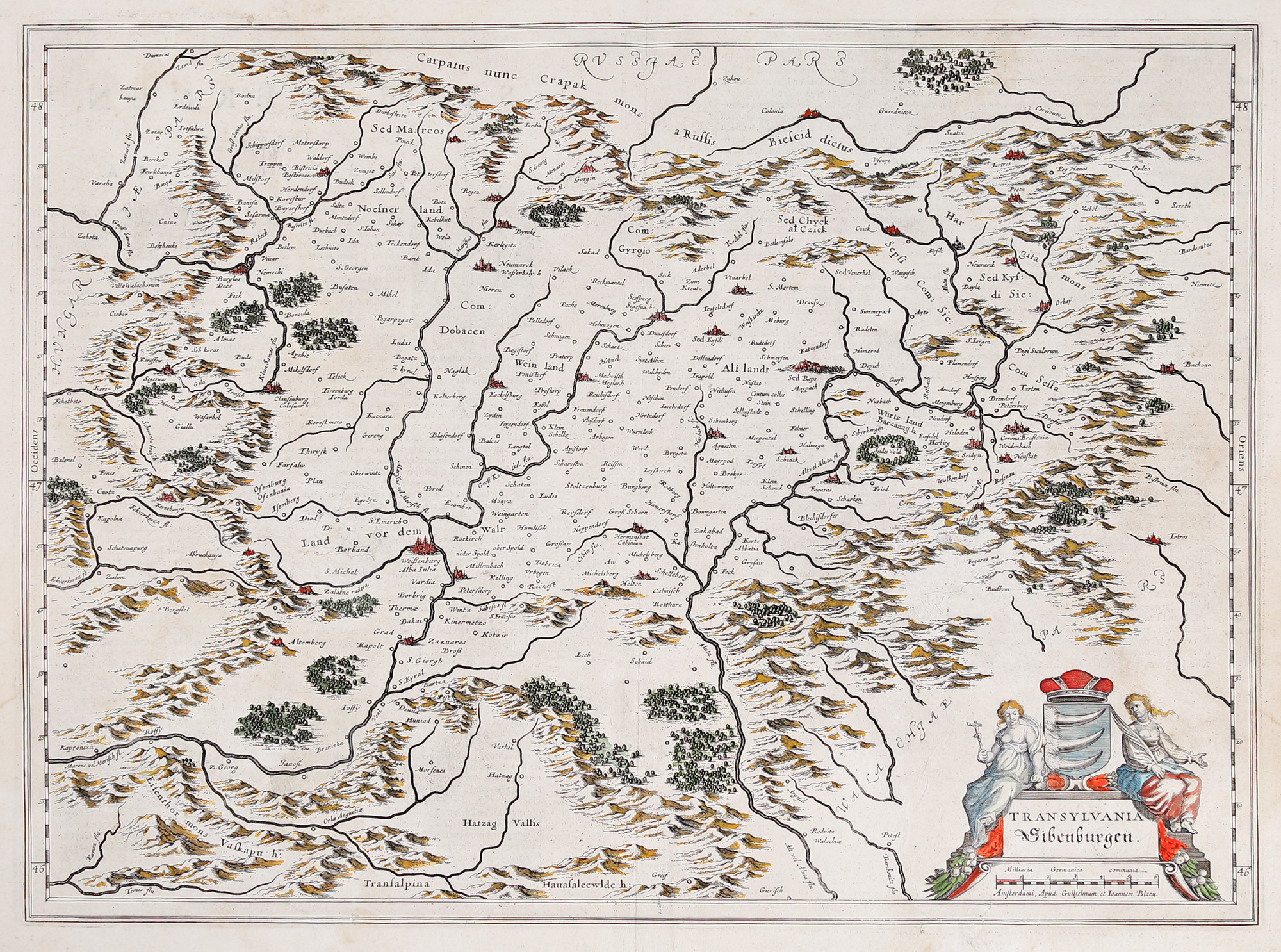
240. "Transylvania" map, by Willem Janszoon Blaeu, Amsterdam, 1636
Starting price
Pretul de pornire si cel estimat nu sunt preturi de vanzare efective
EUR 250
Sold
Pretul de pornire si cel estimat nu sunt preturi de vanzare efective
EUR 400
Session
Tue, 19 July 2022 19:00
Brought to you by
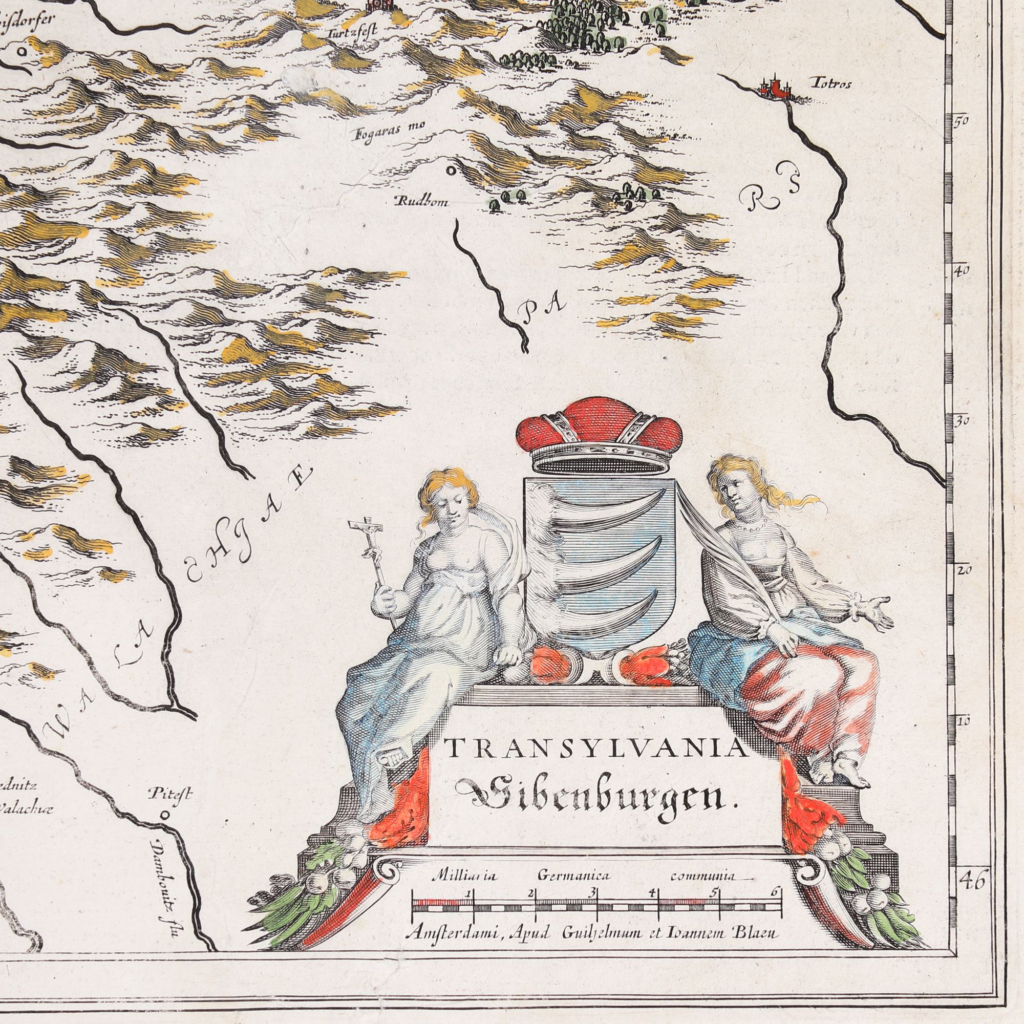
As we know nowadays (KEUNING 1959: 74), W. Blau acquires from Jodocus Hondius Jr. in 1629 a series of engraving plates from Mercator's collection. Thus, except for the cartouche, the map is a copy of the Mercator-Hondius maps, some boards being printed in the Bleau atlas with not too many changes. The board presents Transylvania surrounded by mountains, with "Russia pars" to the north, "Walachiae pars" to the south and "Ungariae pars" to the west, with the division in various regions, without being delimited by borders: Land vor dem Walt (The land before the forest), Weinland (Land of Wine), Altlandt (Old Land), Wurtzland (Burzenland), Nosnerland (Land of Bistrița). It comprises a multitude of localities, the great cities being marked by miniature symbols - boroughs with towers and ramparts - coloured in red: Weisenburg / Alba Iulia, Hermanstat / Cibinum / Sibiu, Clausenburg / Colosvar / Cluj, Cotona / Brasonia / Brașov etc. In the lower right part there is a cartouche adorned with two female characters, Faith and Wisdom, which frame the Bathory Family shield (three bear's claws), one of the characters holding a cross in her hand. Under the cartouche is the graphic scale expressed in German miles.
Dimensions
width 50 cm, height 38 cm, custom 38 Ã 50 cm
Description
copper engraving hand-coloured
Research information
Novus Atlas Edition
ADDITIONAL INFORMATION
For clarifications regarding the bidding procedure, hammer price costs, guarantee, payment, and collection terms for the winning lot, we recommend carefully reading/re-reading the Bidding Regulations.
For additional information regarding the lot and the auction, please contact the Art Consultants Department.
Detalii
As we know nowadays (KEUNING 1959: 74), W. Blau acquires from Jodocus Hondius Jr. in 1629 a series of engraving plates from Mercator's collection. Thus, except for the cartouche, the map is a copy of the Mercator-Hondius maps, some boards being printed in the Bleau atlas with not too many changes. The board presents Transylvania surrounded by mountains, with "Russia pars" to the north, "Walachiae pars" to the south and "Ungariae pars" to the west, with the division in various regions, without being delimited by borders: Land vor dem Walt (The land before the forest), Weinland (Land of Wine), Altlandt (Old Land), Wurtzland (Burzenland), Nosnerland (Land of Bistrița). It comprises a multitude of localities, the great cities being marked by miniature symbols - boroughs with towers and ramparts - coloured in red: Weisenburg / Alba Iulia, Hermanstat / Cibinum / Sibiu, Clausenburg / Colosvar / Cluj, Cotona / Brasonia / Brașov etc. In the lower right part there is a cartouche adorned with two female characters, Faith and Wisdom, which frame the Bathory Family shield (three bear's claws), one of the characters holding a cross in her hand. Under the cartouche is the graphic scale expressed in German miles.
ADDITIONAL INFORMATION
For clarifications regarding the bidding procedure, hammer price costs, guarantee, payment, and collection terms for the winning lot, we recommend carefully reading/re-reading the Bidding Regulations.
For additional information regarding the lot and the auction, please contact the Art Consultants Department.
Dimensions
width 50 cm, height 38 cm, custom 38 Ã 50 cm
Description
copper engraving hand-coloured
Research information
Novus Atlas Edition
Brought to you by
Similar lots
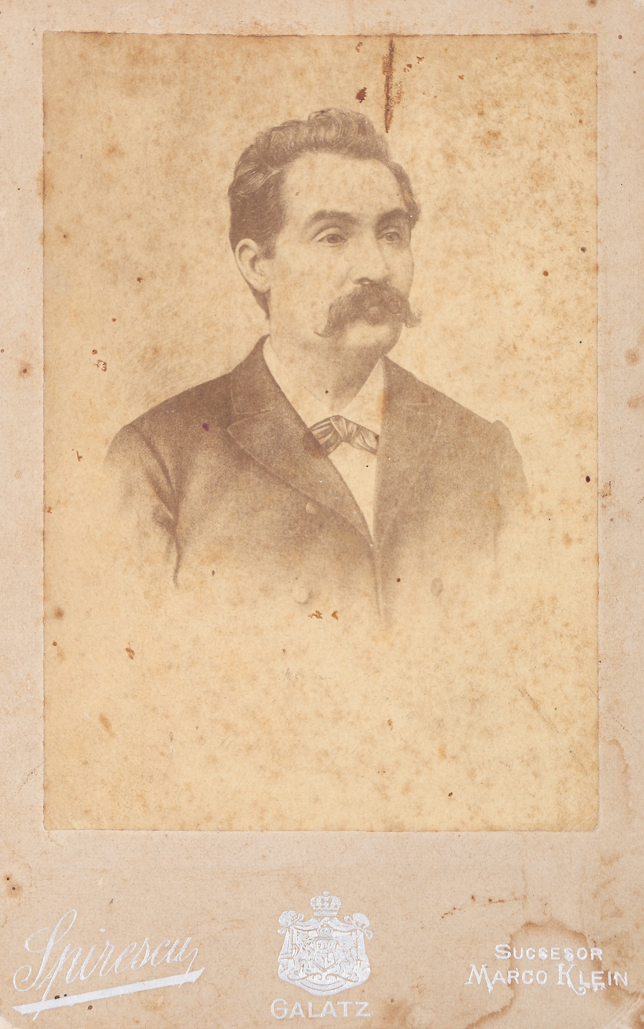
40. The last known photograph of the poet Mihai Eminescu, taken after Jean Bielig's cliché, Galați, 1887-1888, extremely rare collector's item
Starting price
EUR 800
Sold
EUR 6.000