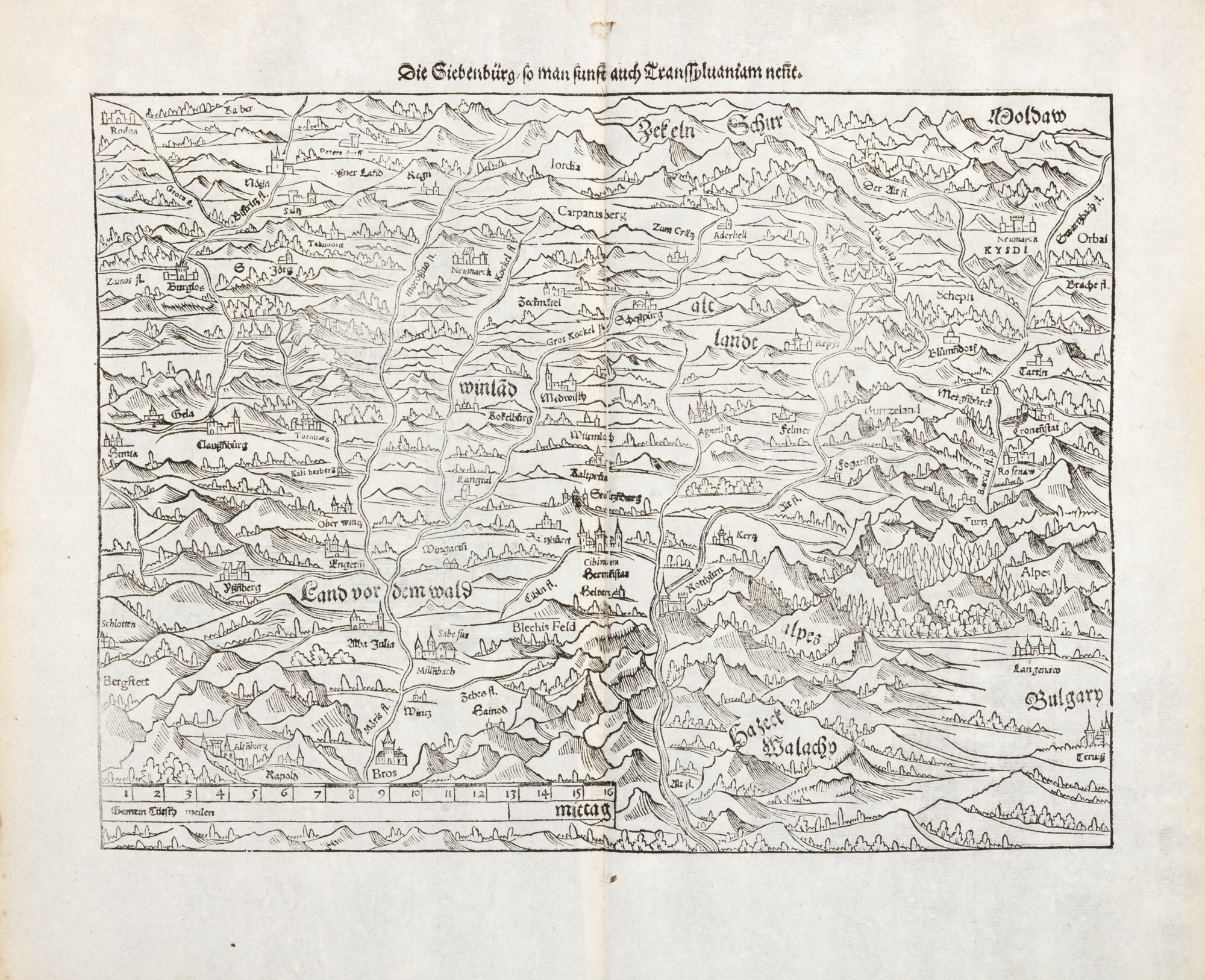
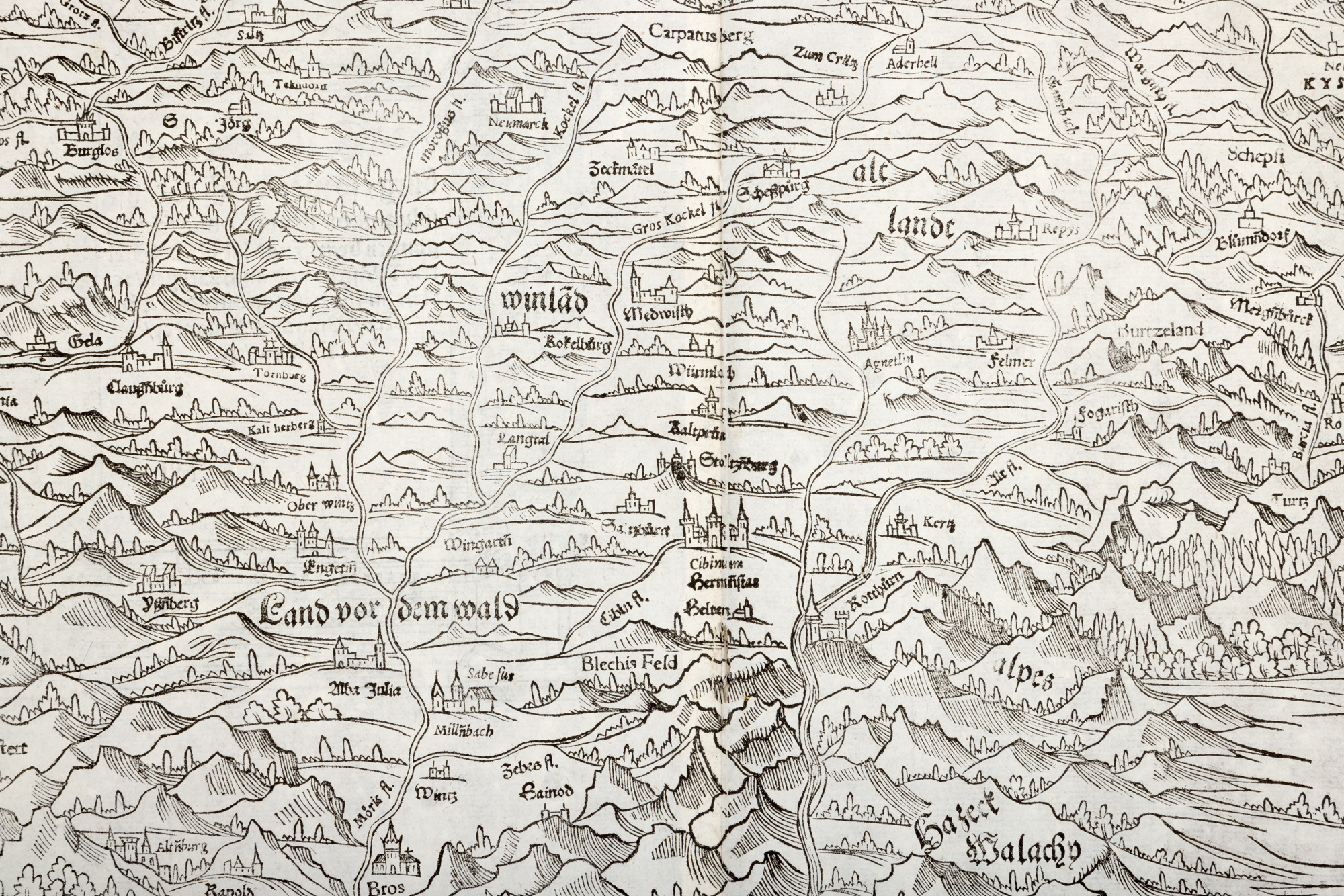
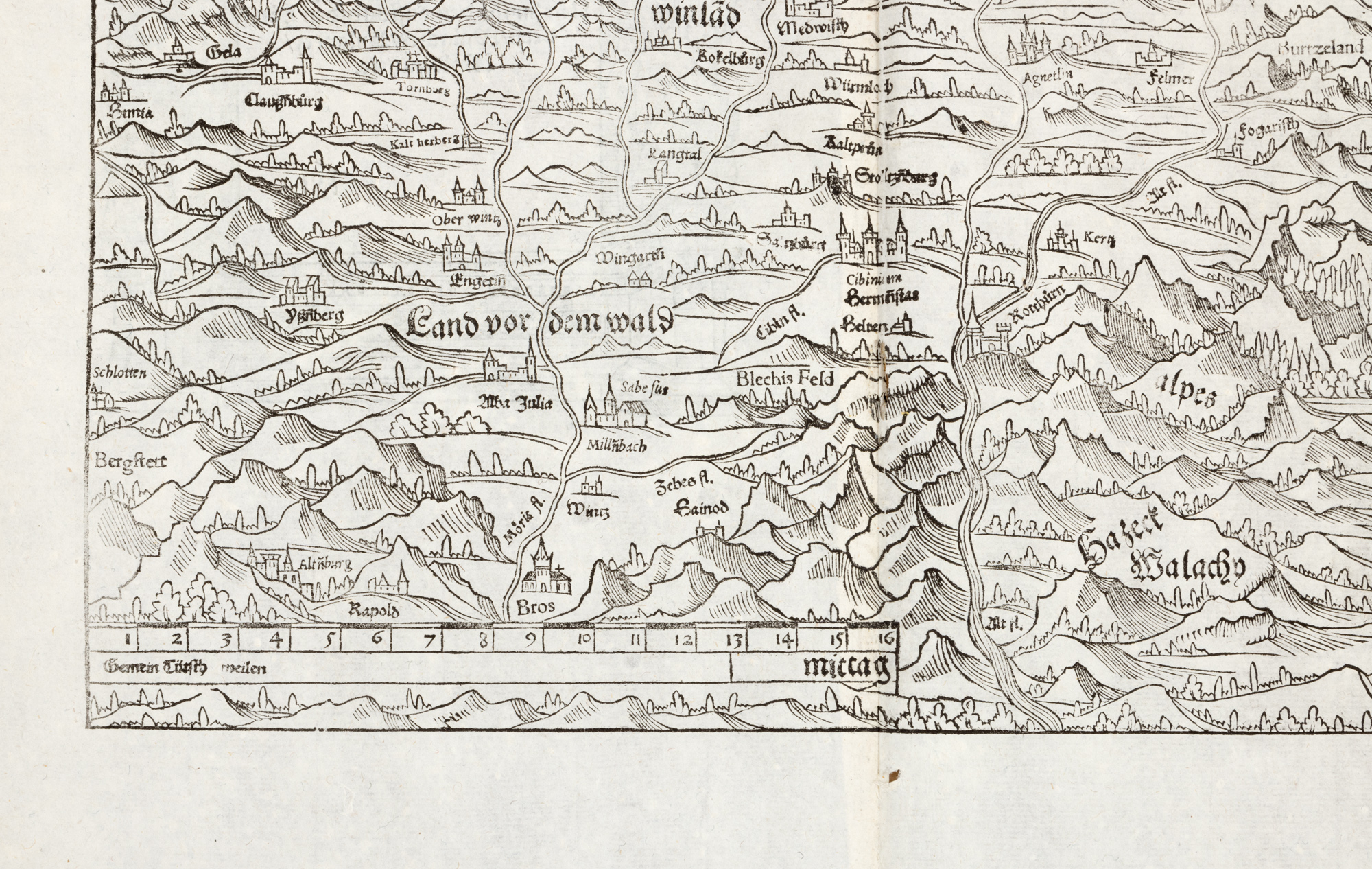
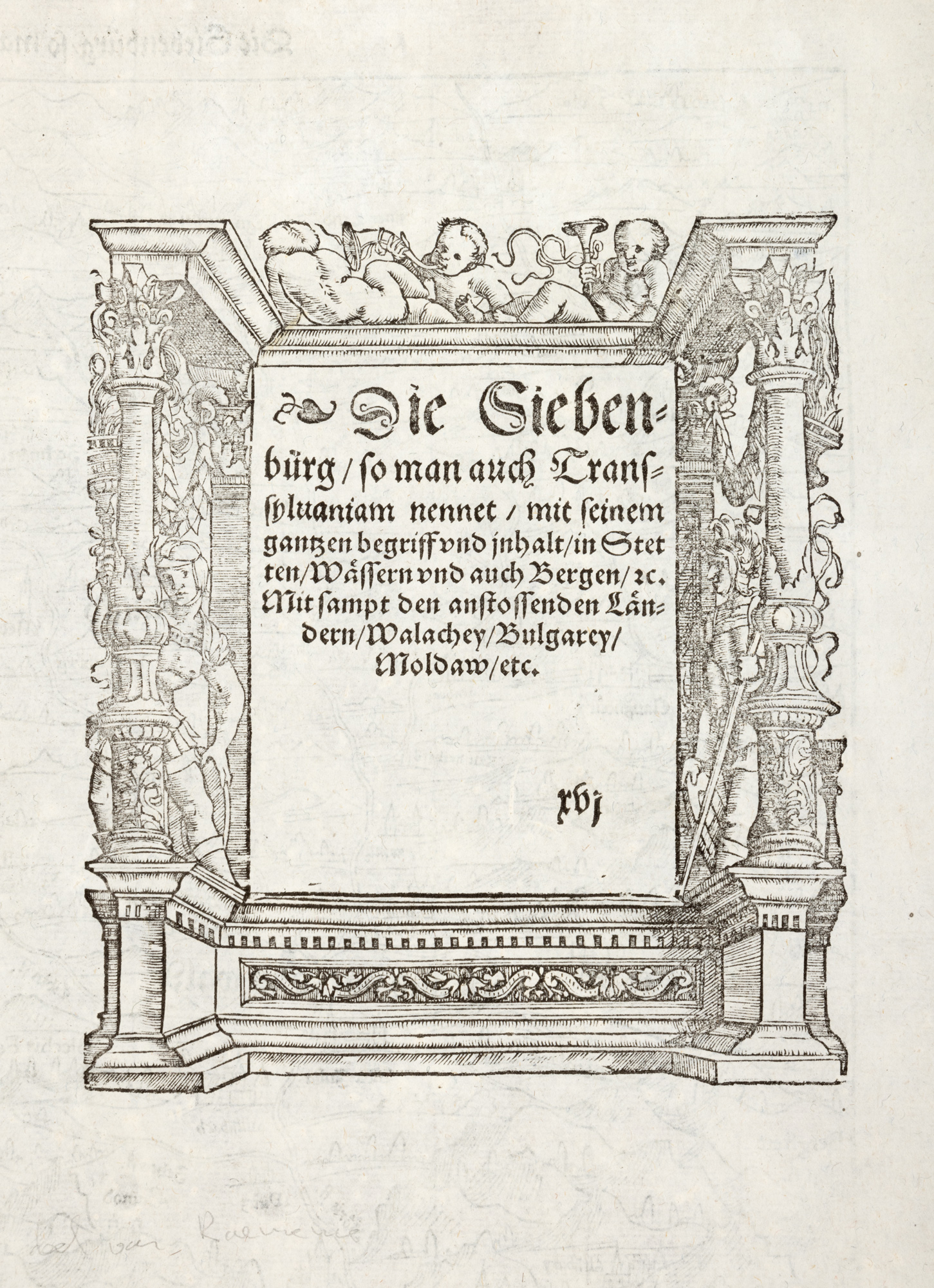
235. "Transylvania" Map, by Sebastian Münster, Basel, 1578, rare piece
Selling price
EUR 375
Session
Tue, 24 June 2025 18:00
Dimensions
custom 34 x 42 cm
Description
woodcut, laid paper
ADDITIONAL INFORMATION
For clarifications regarding the bidding procedure, hammer price costs, guarantee, payment, and collection terms for the winning lot, we recommend carefully reading/re-reading the Bidding Regulations.
For additional information regarding the lot and the auction, please contact the Art Consultants Department.
Detalii
ADDITIONAL INFORMATION
For clarifications regarding the bidding procedure, hammer price costs, guarantee, payment, and collection terms for the winning lot, we recommend carefully reading/re-reading the Bidding Regulations.
For additional information regarding the lot and the auction, please contact the Art Consultants Department.
Similar lots
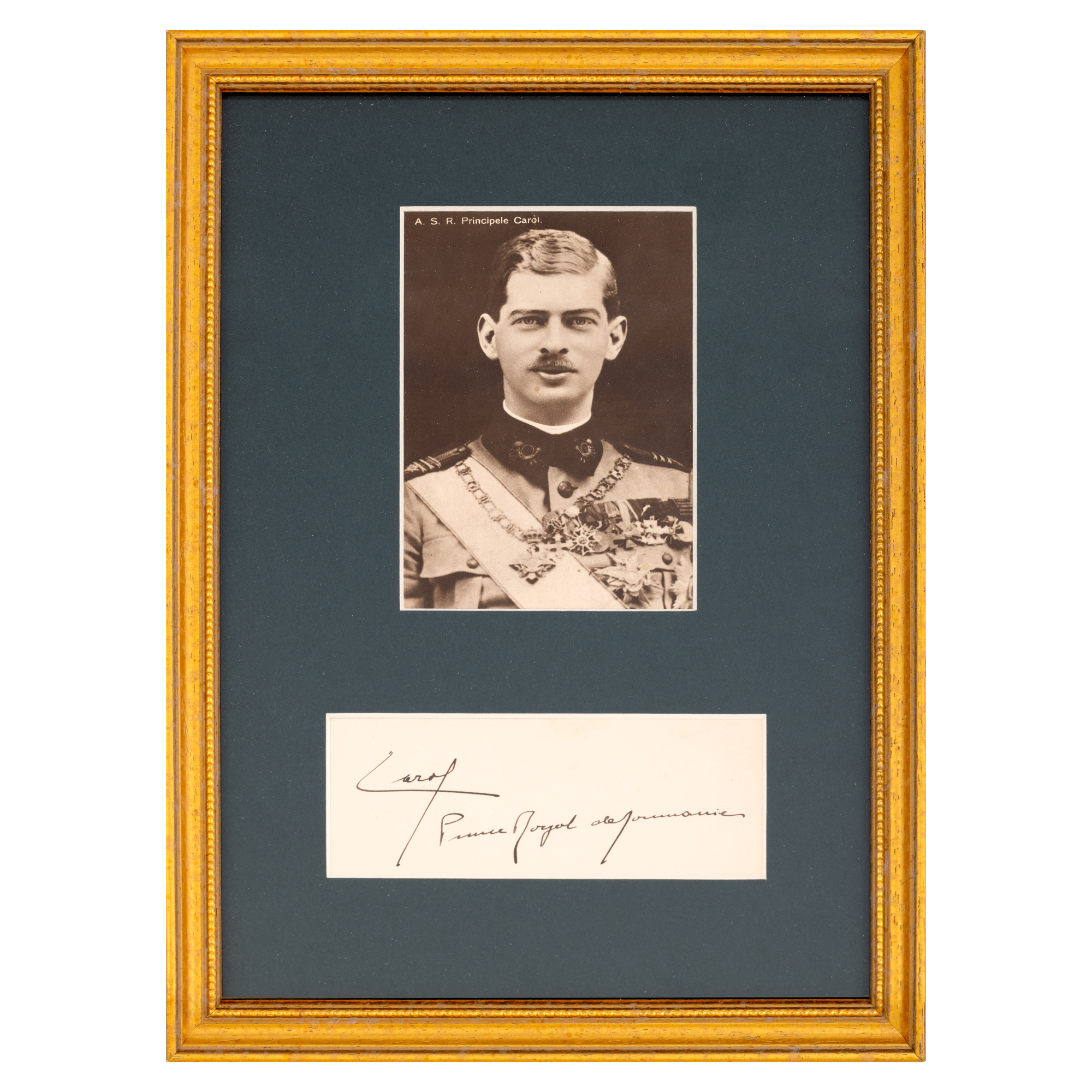
252. Lot consisting of photographic postcard illustrating Prince Carol, cca. 1925, and the handwritten signature of the prince