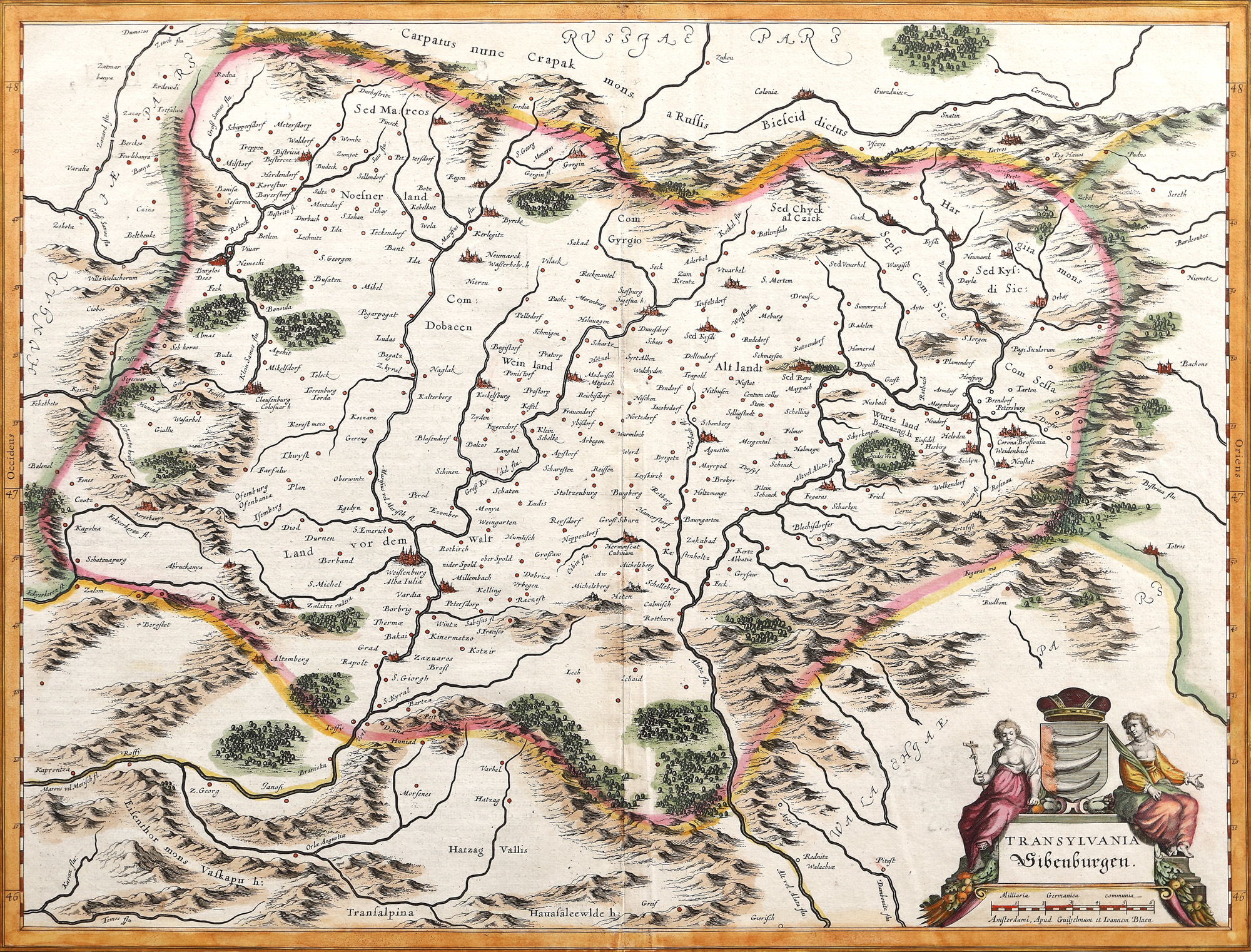
33. Map "Transylvania", by Willem Janszoon Blaeu, Amsterdam, 1636
Начална цена
EUR 490
Продадено
EUR 1.200
Сесия
Вто, 5 април 2022 19:00
Размери
width 49.5 cm, height 38 cm
Описание
copper engraving, laid paper, hand-coloured
Информация от изследване
Novus Atlas edition.
ДОПЪЛНИТЕЛНА ИНФОРМАЦИЯ
За разяснения относно процедурата по наддаване, разходите при спечелване, условията за гаранция, плащане и вземане на спечеления лот, препоръчваме внимателно четене/препрочитане на Правилника за наддаване.
За допълнителна информация относно лота и търга, моля свържете се с Отдела на арт консултантите.
Detalii
ДОПЪЛНИТЕЛНА ИНФОРМАЦИЯ
За разяснения относно процедурата по наддаване, разходите при спечелване, условията за гаранция, плащане и вземане на спечеления лот, препоръчваме внимателно четене/препрочитане на Правилника за наддаване.
За допълнителна информация относно лота и търга, моля свържете се с Отдела на арт консултантите.
Размери
width 49.5 cm, height 38 cm
Описание
copper engraving, laid paper, hand-coloured
Информация от изследване
Novus Atlas edition.
Алтернативни лотове
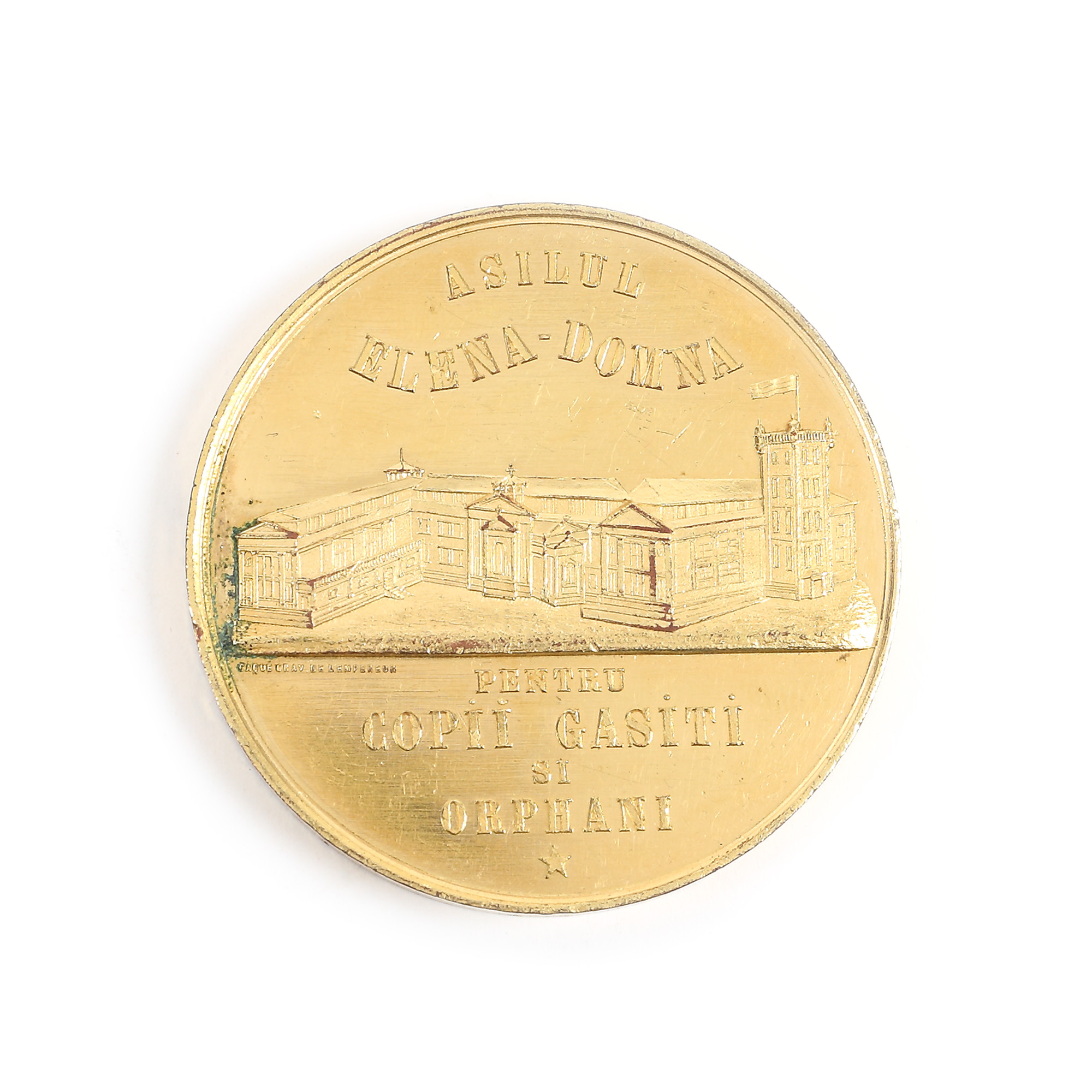
177. Medal dedicated to the founding of the Elena Doamna Asylum, 1862