Meniu

Продай / Продай
Контакт
Моят профил
Български

Открийте

Арт консултанти

Отдели търгове


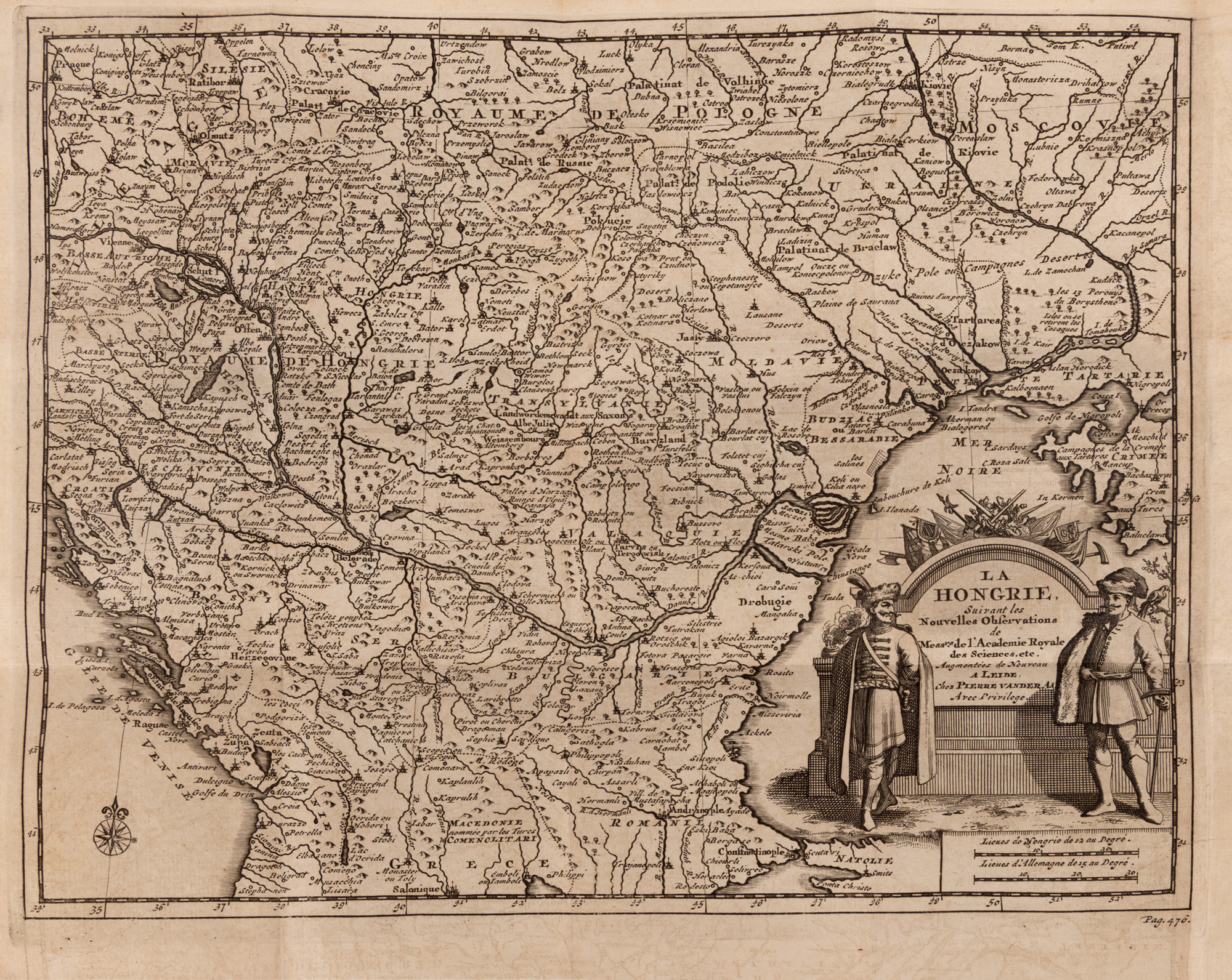
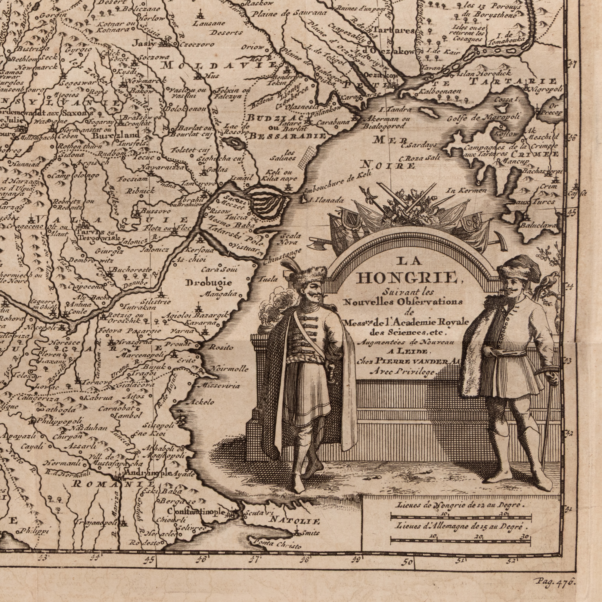
196. "Map 'Hungary', along with the Romanian Countries, by Pieter van der Aa, Leiden, circa 1714"

Начална цена

EUR 200

Сесия

Сря, 1 юли 2026 19:00

0 Zile, 14 Ore, 56 Minute

ОСТАВАЩО ВРЕМЕ ДО ЗАПОЧВАНЕТО НА ТЪРГА НА ЖИВО

The original title, "La Hongrie", identifies the main territory represented, but the composition extends over a much larger area of Central and South-East Europe. Alongside the Kingdom of Hungary, Transylvania, Moldova, Bessarabia and Wallachia are depicted in an overview that allows the observation of geographical and political relations between these provinces at the beginning of the eighteenth century. Territories, borders and main urban centers are represented through a meticulous network of routes, names and conventional signs. Mountain ranges are pictorially represented, by successions of stylized shapes, and watercourses structure the composition and highlight the importance of the Danube and its major tributaries. The numerous toponyms transform the map into a veritable visual archive, where one can track historic names, cities, fortresses and regions whose borders were to be modified in the following centuries. The ornamental cartouche gives the work a pronounced artistic dimension. Specific to the Baroque taste, it turns geographical information into a decorative composition, designed not only for consultation, but also to impress the viewer. The fineness of the lines incised in the copper plate, the balance between inscribed surfaces and geographical areas, as well as the texture of the laid paper retains the charm of the objects printed in the great European workshops of the time. The map was published at a time of profound transformation of the region. After the conflicts between the Habsburg Empire and the Ottoman Empire in the late seventeenth and early eighteenth centuries, Central Europe and the Romanian territories were at the center of Western political and strategic concerns. Seen today, the piece not only offers a geographical representation, but captures the way in which this border space was known, ordered, and imagined in the West. Beyond its interest for collectors of old cartography, the map appeals to enthusiasts of history, travel, genealogy and European culture. For a viewer originating from one of the territories depicted, it offers the rare experience of discovering familiar places through the perspective of a cartographer from over three centuries ago. Through its graphic elegance and the wealth of historical information, the work can be a point of attraction in a library, an office or a contemporary interior. It is equally a document, a graphic work and a decorative object: an image of Europe of old and a testament to the era when the map was one of the most spectacular forms of knowledge of the world.

Размери

width 23.5 cm, height 24.5 cm

Описание

copper engraving, 23.50x24.50

ДОПЪЛНИТЕЛНА ИНФОРМАЦИЯ

За разяснения относно процедурата по наддаване, разходите при спечелване, условията за гаранция, плащане и вземане на спечеления лот, препоръчваме внимателно четене/препрочитане на Правилника за наддаване.

За допълнителна информация относно лота и търга, моля свържете се с Отдела на арт консултантите.

Алтернативни лотове

Icon on glass, "Saint Haralambie the plague deliverer", workshop from Scheii Brasovului, second half of the 19th century

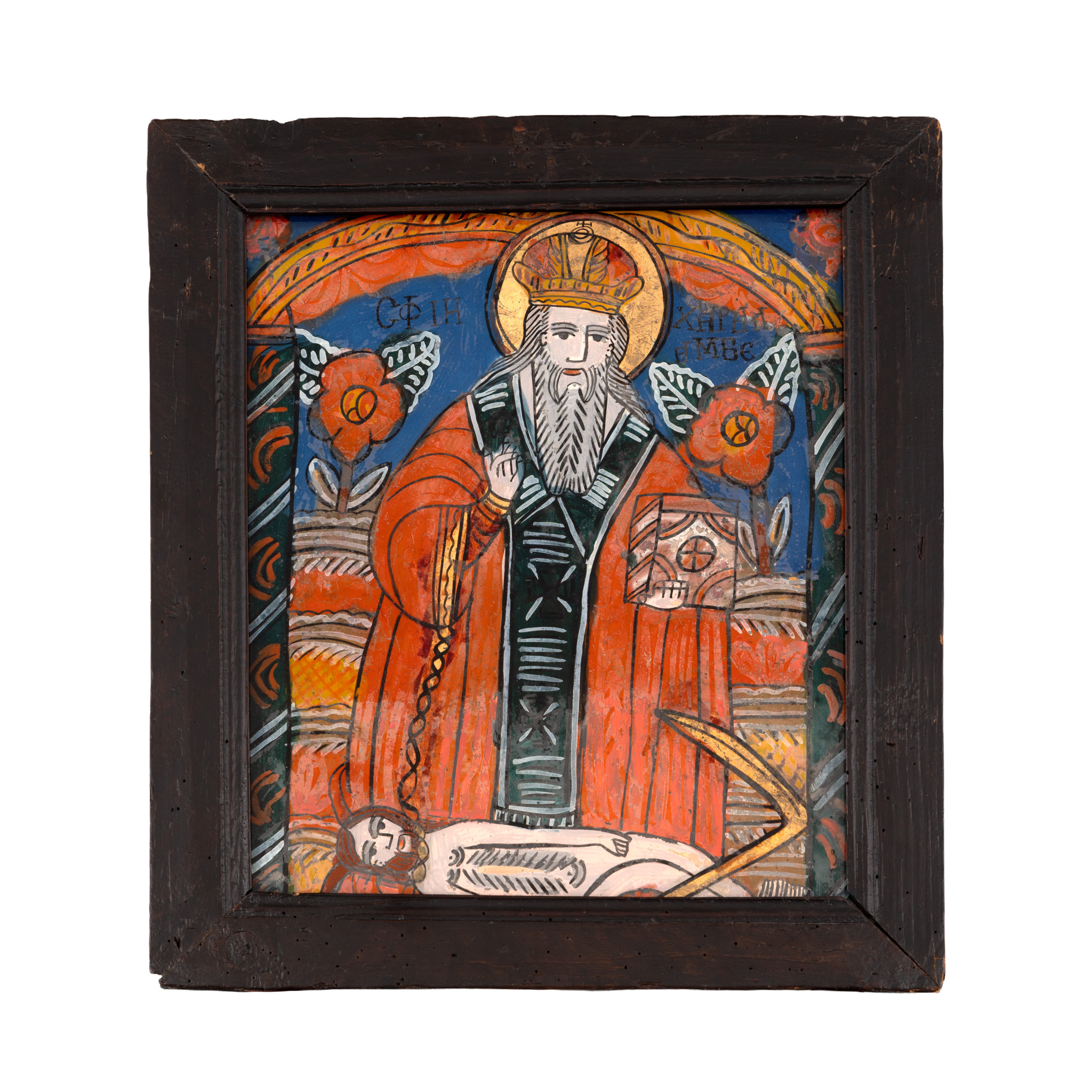
113. Icon on glass, "Saint Haralambie the plague deliverer", workshop from Scheii Brasovului, second half of the 19th century

    Начална цена EUR 300

0 Zile, 14 Ore, 56 Minute

ОСТАВАЩО ВРЕМЕ ДО ЗАПОЧВАНЕТО НА ТЪРГА НА ЖИВО

"Transylvania. The Land Beyond the Forest" by Louis C. Cornish, English, Philadelphia, 1947

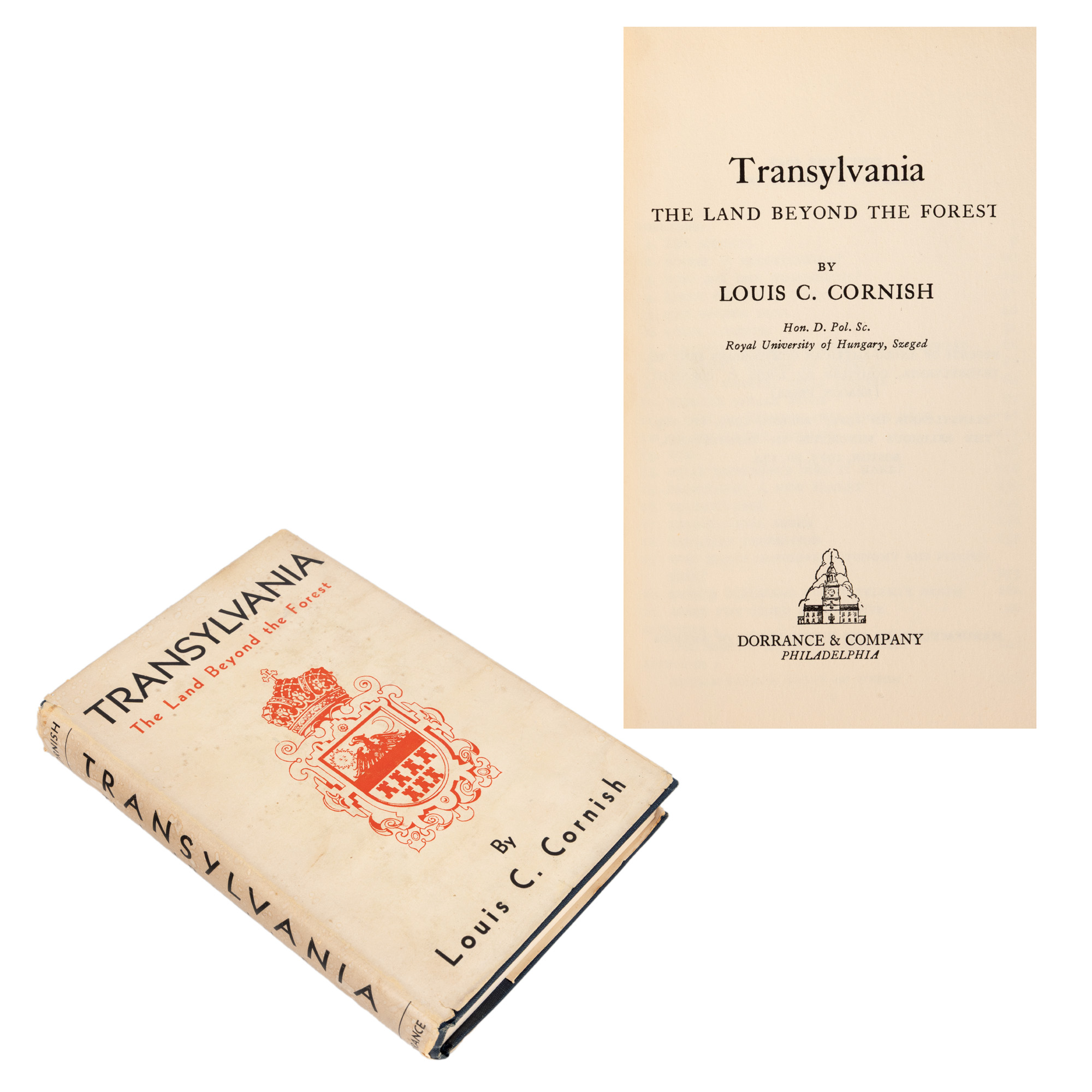
221. "Transylvania. The Land Beyond the Forest" by Louis C. Cornish, English, Philadelphia, 1947

    Начална цена EUR 35

0 Zile, 14 Ore, 56 Minute

ОСТАВАЩО ВРЕМЕ ДО ЗАПОЧВАНЕТО НА ТЪРГА НА ЖИВО

Medal "Peace Treaty of Bucharest from 1913", engraver Constantin Alessandrescu, cca. 1913

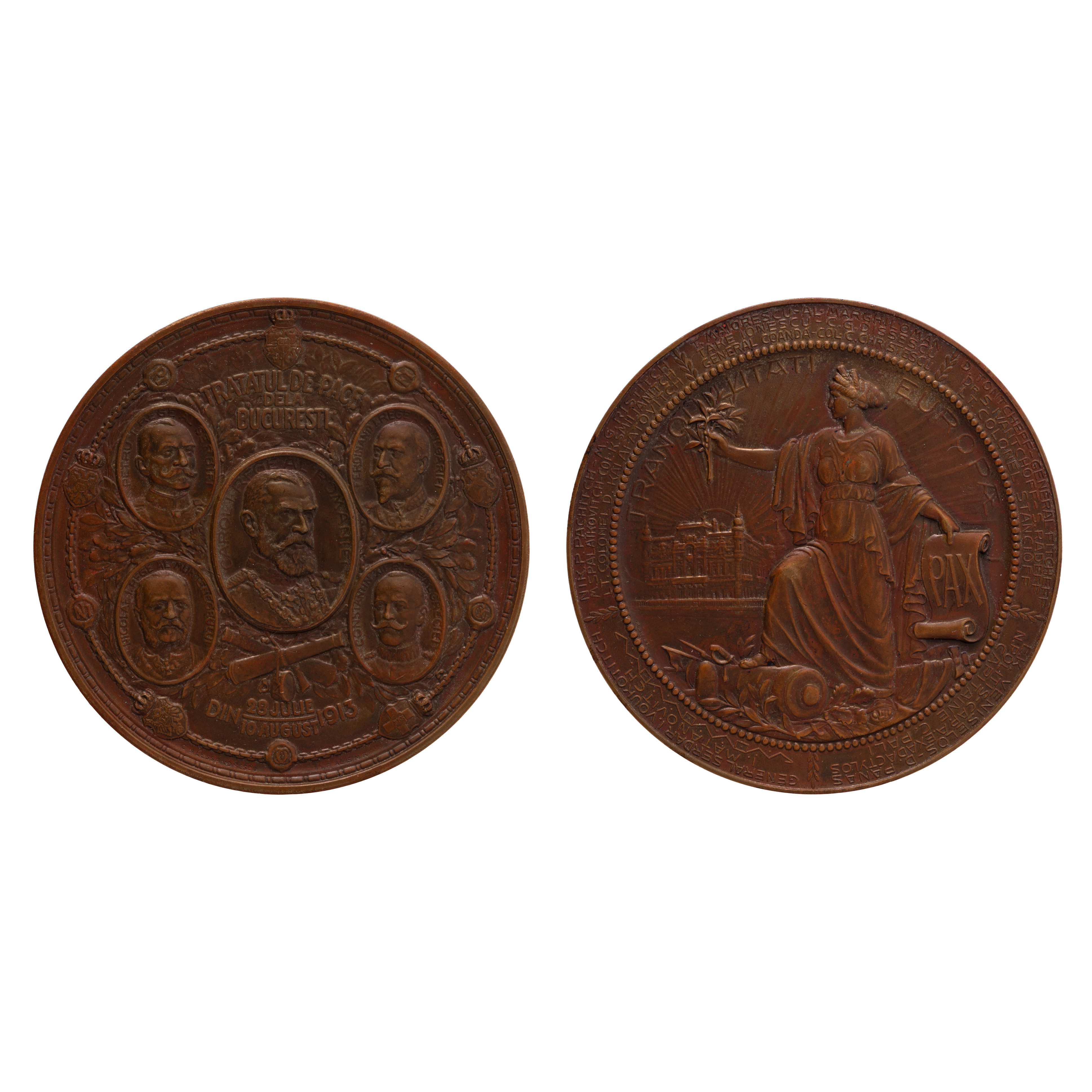
14Ц. Medal "Peace Treaty of Bucharest from 1913", engraver Constantin Alessandrescu, cca. 1913

    Начална цена EUR 250

0 Zile, 14 Ore, 56 Minute

ОСТАВАЩО ВРЕМЕ ДО ЗАПОЧВАНЕТО НА ТЪРГА НА ЖИВО

"Map of 'Târnava Mare County', Unirea Cartographic Institute, Brașov, cca. 1930"

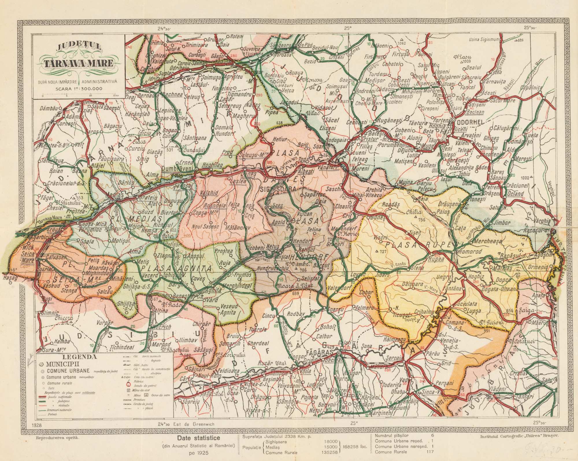
205. "Map of 'Târnava Mare County', Unirea Cartographic Institute, Brașov, cca. 1930"

    Начална цена EUR 100

0 Zile, 14 Ore, 56 Minute

ОСТАВАЩО ВРЕМЕ ДО ЗАПОЧВАНЕТО НА ТЪРГА НА ЖИВО