


The photos of the lot are informative and indicative, and cannot provide a highly detailed view of the object from all angles. We recommend a careful physical inspection of the lot before bidding.
The photos of the lot are informative and indicative, and cannot provide a highly detailed view of the object from all angles. We recommend a careful physical inspection of the lot before bidding.
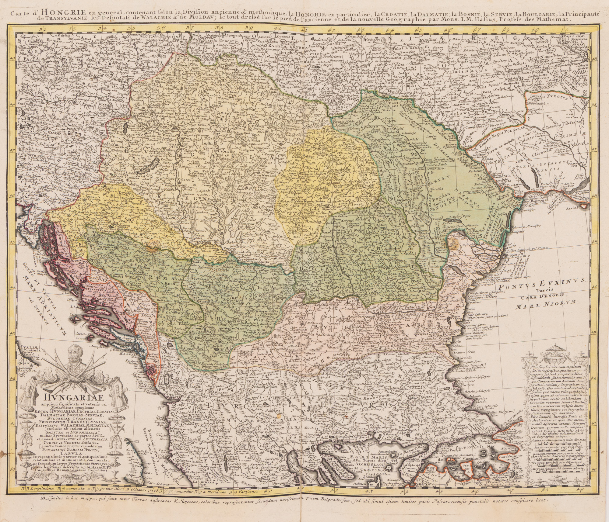
197. Map "Hungary, Croatia, Dalmatia, Bosnia, Bulgaria, Principality of Transylvania, Wallachia and Moldova", by Johann Matthias Hase, 1744
Starting price
Pretul de pornire si cel estimat nu sunt preturi de vanzare efective
EUR 200
Session
Wed, 1 July 2026 19:00
0 Zile, 14 Ore, 53 Minute
Time remaining until live auction starts
Brought to you by
The map is part of "The Great Atlas" published by German geographer and cartographer Johannes Homann (1663-1724). After the death of the geographer, his son continued the publication of this highly appreciated and well-known work in the German-speaking European space. The copy is from an edition that appeared in 1744. Copper engraving manually colored after printing.
Dimensions
custom 47 x 58 cm
Description
hand-colored copper engraving
ADDITIONAL INFORMATION
For clarifications regarding the bidding procedure, hammer price costs, guarantee, payment, and collection terms for the winning lot, we recommend carefully reading/re-reading the Bidding Regulations.
For additional information regarding the lot and the auction, please contact the Art Consultants Department.
Detalii
The map is part of "The Great Atlas" published by German geographer and cartographer Johannes Homann (1663-1724). After the death of the geographer, his son continued the publication of this highly appreciated and well-known work in the German-speaking European space. The copy is from an edition that appeared in 1744. Copper engraving manually colored after printing.
ADDITIONAL INFORMATION
For clarifications regarding the bidding procedure, hammer price costs, guarantee, payment, and collection terms for the winning lot, we recommend carefully reading/re-reading the Bidding Regulations.
For additional information regarding the lot and the auction, please contact the Art Consultants Department.
Dimensions
custom 47 x 58 cm
Description
hand-colored copper engraving
Brought to you by
Similar lots
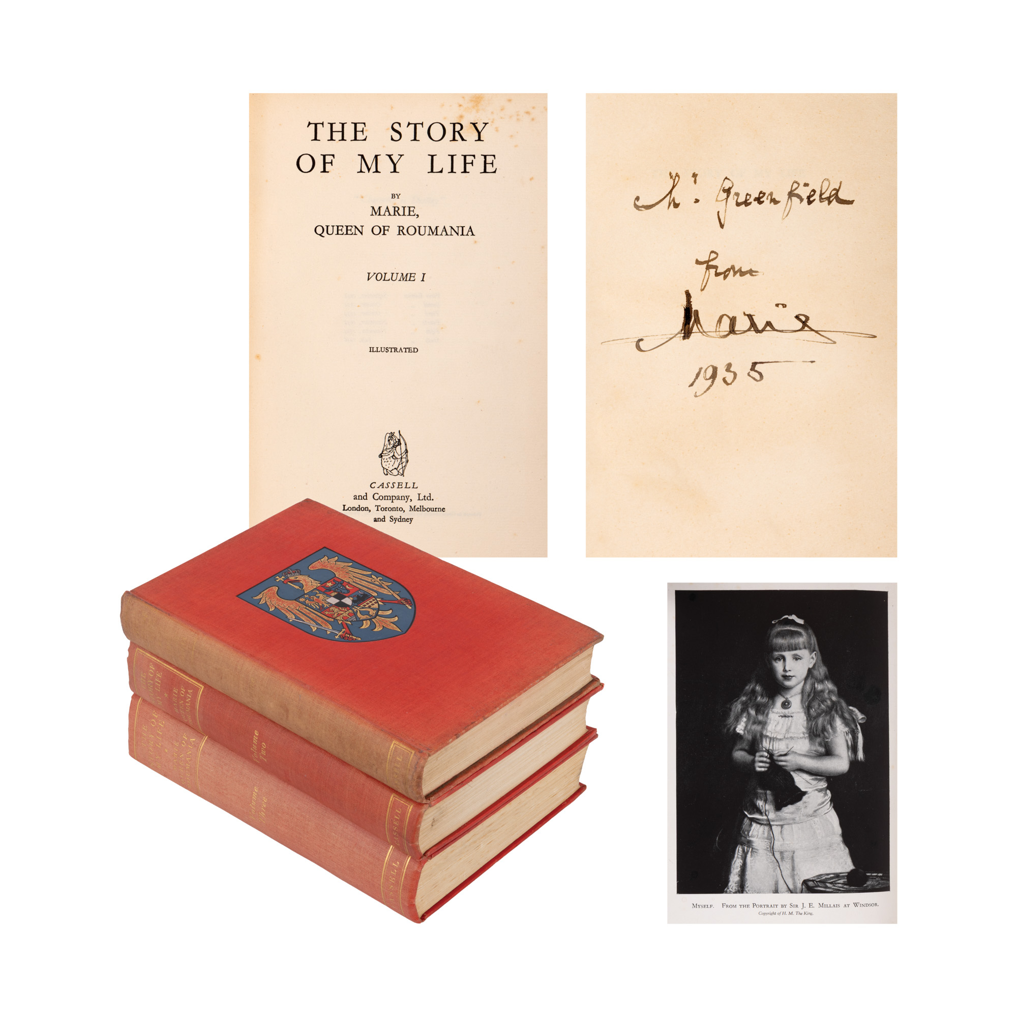
222. "The Story of My Life", by Queen Marie of Romania, volumes I-III, English, London, 1934-1936, with dedication and handwritten signature of the author
Starting price
EUR 500
0 Zile, 14 Ore, 53 Minute
Time remaining until live auction starts
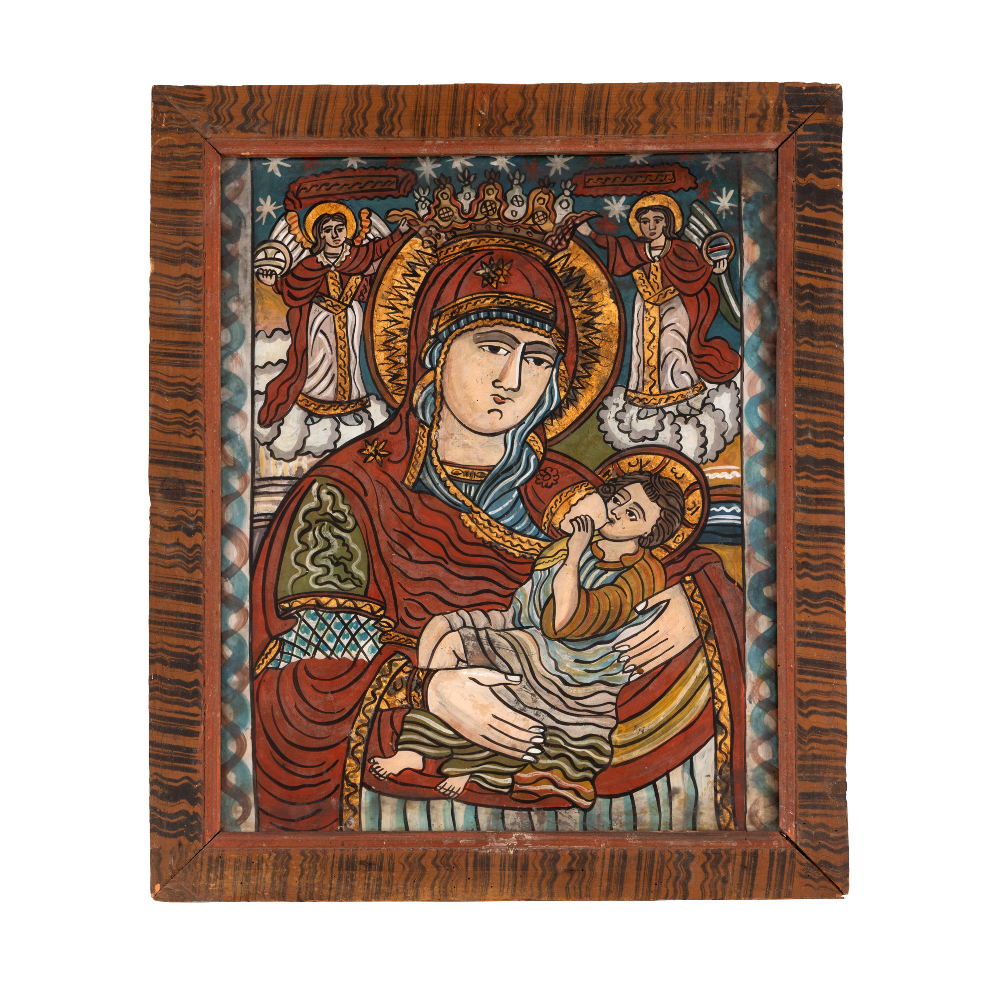
111. Glass Icon, "Mother of God - The Nursing One", workshop in Scheii Brasovului, end of the 19th century
Starting price
EUR 450
0 Zile, 14 Ore, 53 Minute
Time remaining until live auction starts
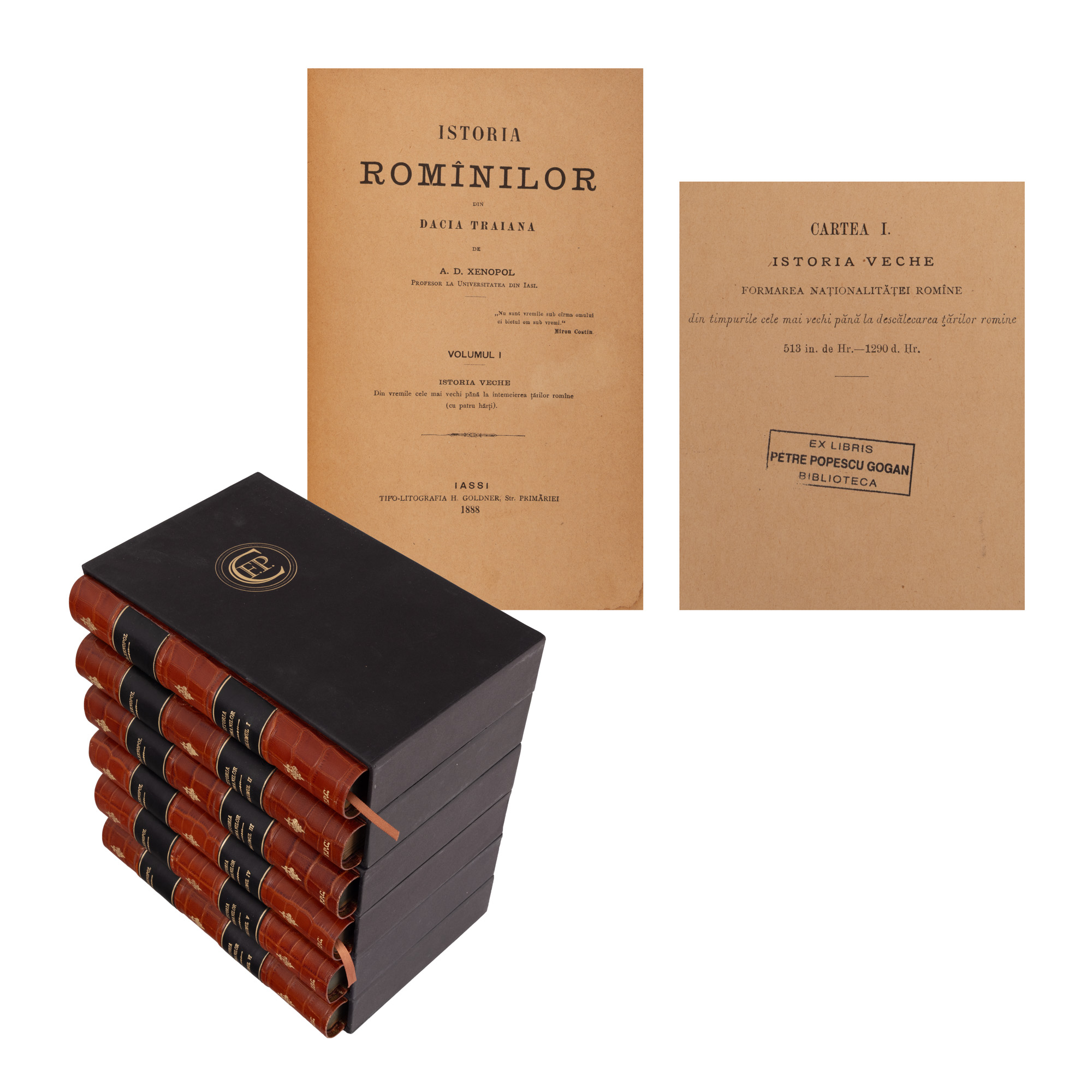
34. "The History of the Romanians" by A.D. Xenopol, 12 volumes bound in six tomes, Iași, 1888-1893, bibliophile edition
Starting price
EUR 500
0 Zile, 14 Ore, 53 Minute
Time remaining until live auction starts
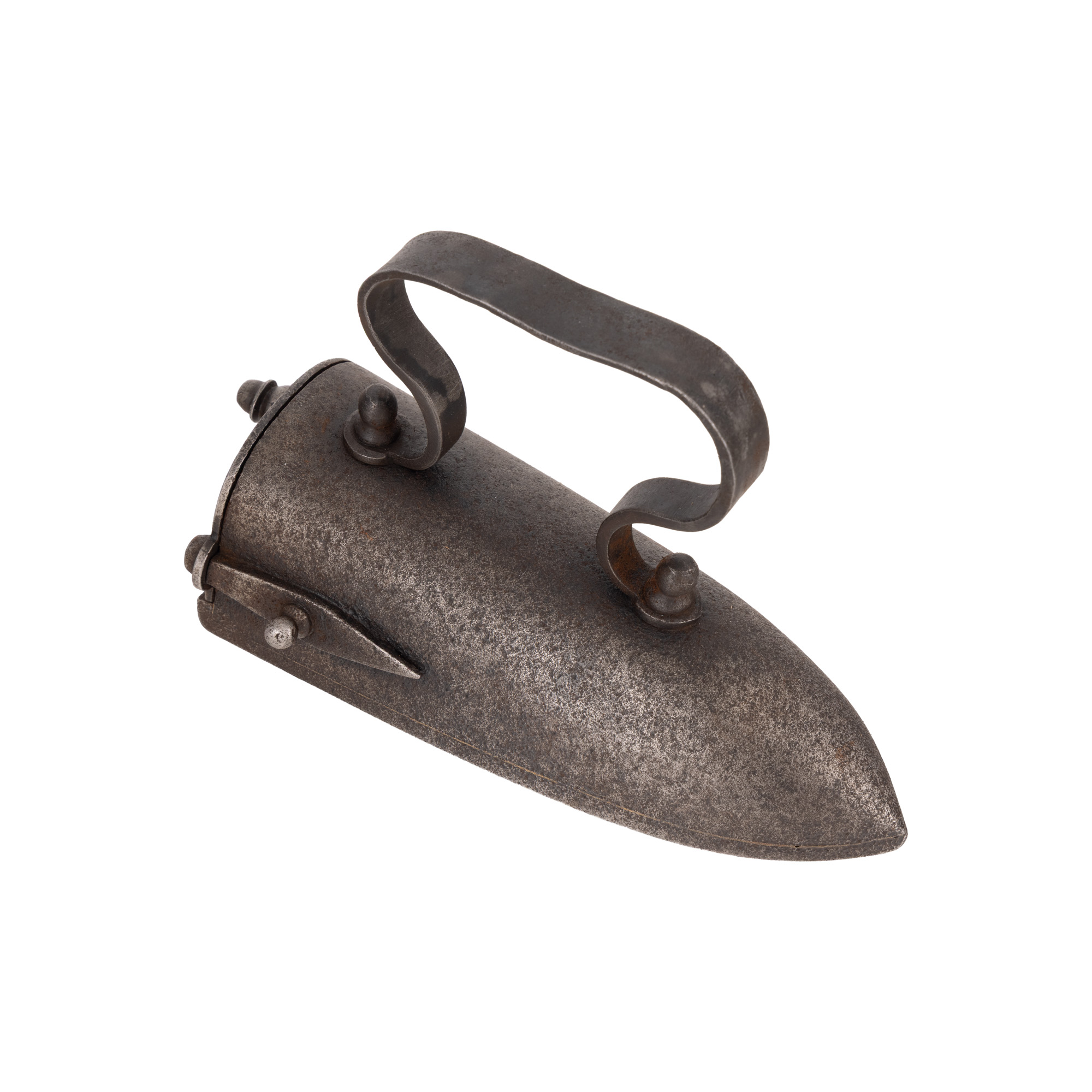
56. Iron used in Transylvania, probably Transylvanian workshop, 19th century
Starting price
EUR 50
0 Zile, 14 Ore, 53 Minute
Time remaining until live auction starts