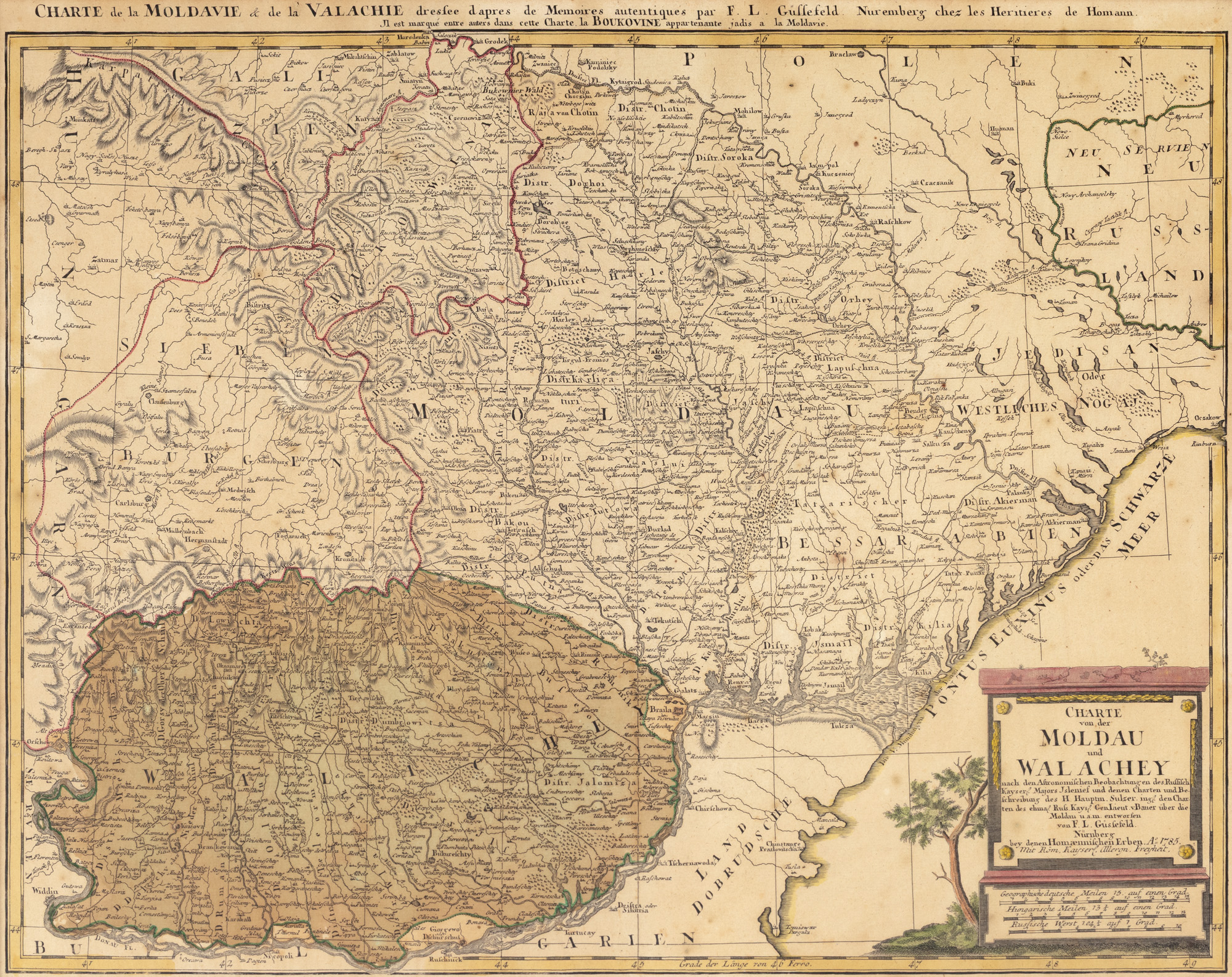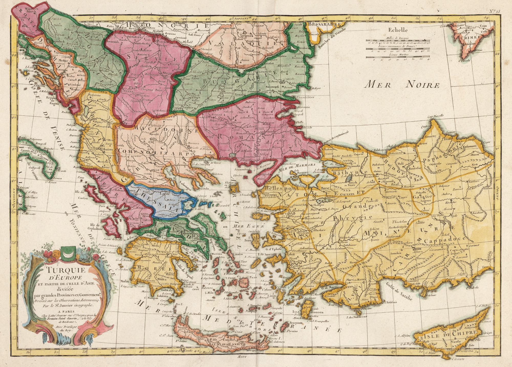
284. "Map 'European Turkey and a part of Asian Turkey', drawn by Jean Janvier, published by Jean Lattré, Paris, 1775"
Начална цена
EUR 200
Продадено
EUR 200
Сесия
Вто, 7 октомври 2025 12:00
Размери
width 49 cm, height 36 cm
Описание
copper engraving, striped paper, hand colored
ДОПЪЛНИТЕЛНА ИНФОРМАЦИЯ
За разяснения относно процедурата по наддаване, разходите при спечелване, условията за гаранция, плащане и вземане на спечеления лот, препоръчваме внимателно четене/препрочитане на Правилника за наддаване.
За допълнителна информация относно лота и търга, моля свържете се с Отдела на арт консултантите.
Detalii
ДОПЪЛНИТЕЛНА ИНФОРМАЦИЯ
За разяснения относно процедурата по наддаване, разходите при спечелване, условията за гаранция, плащане и вземане на спечеления лот, препоръчваме внимателно четене/препрочитане на Правилника за наддаване.
За допълнителна информация относно лота и търга, моля свържете се с Отдела на арт консултантите.
Размери
width 49 cm, height 36 cm
Описание
copper engraving, striped paper, hand colored
Алтернативни лотове

229. Original maquette of a advertising poster by Anamaria Buzea, Animafilm Studio, circa 1976
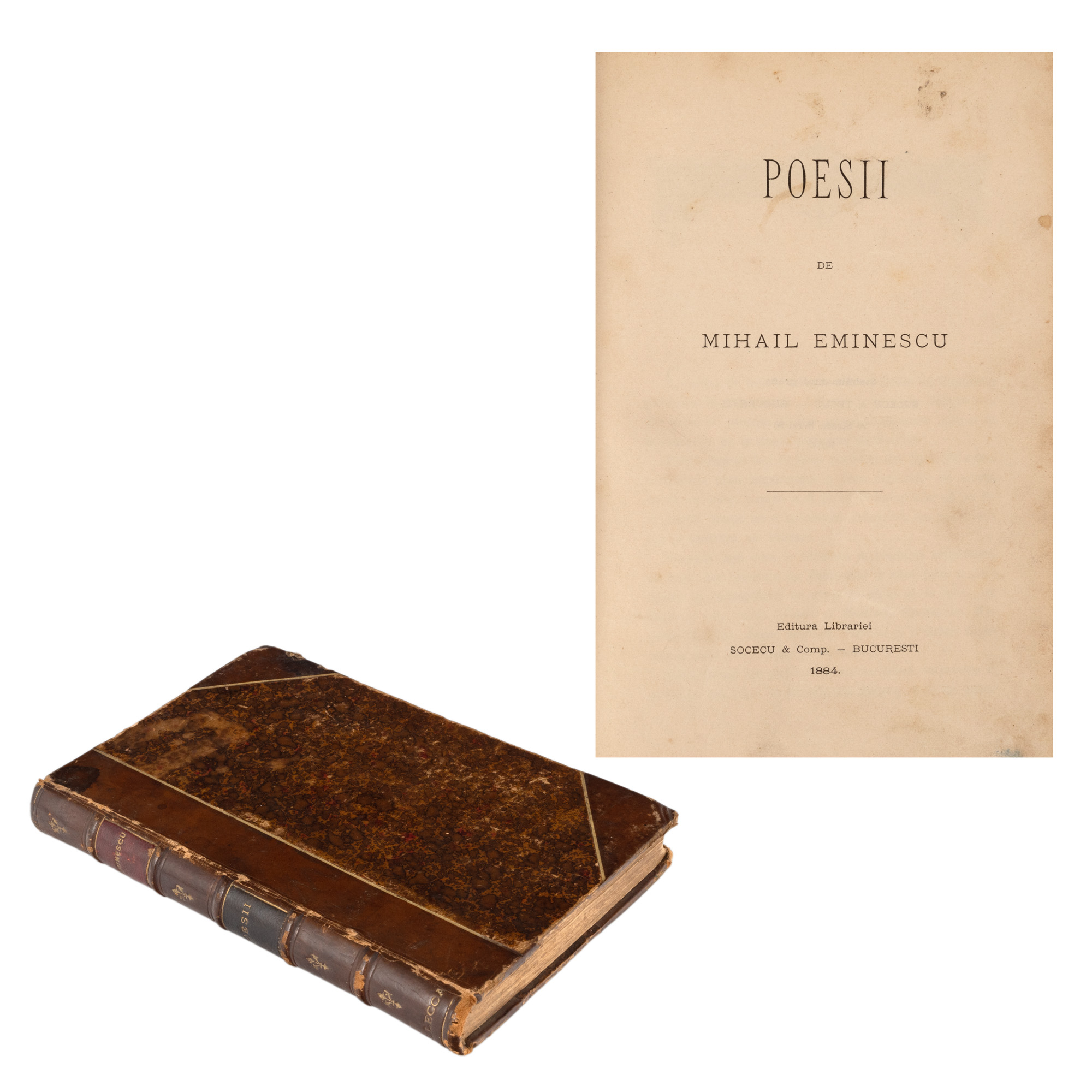
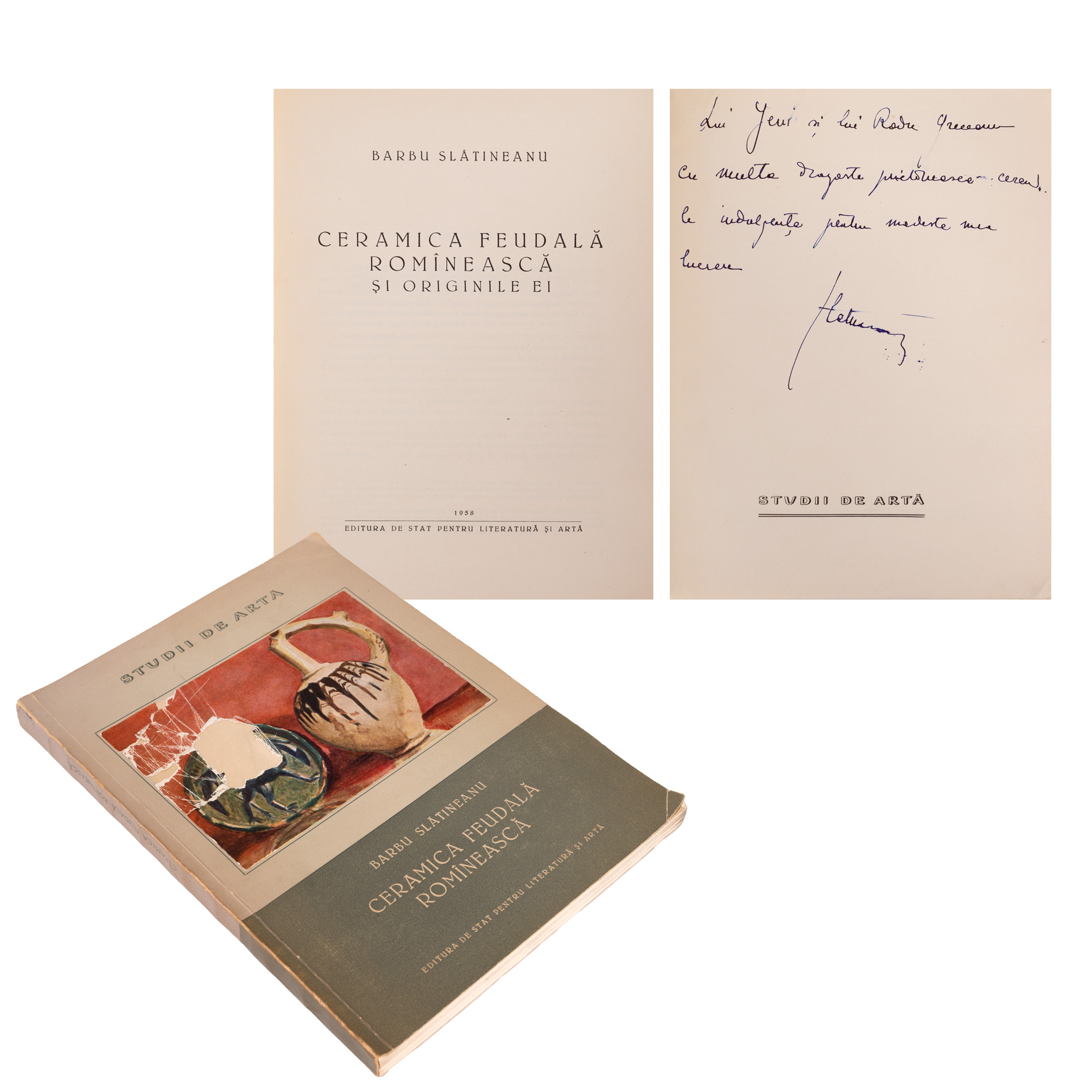
35. "Poesii" by Mihai Eminescu, Bucharest, 1884, first edition, from Ioan G. Lecca's collection