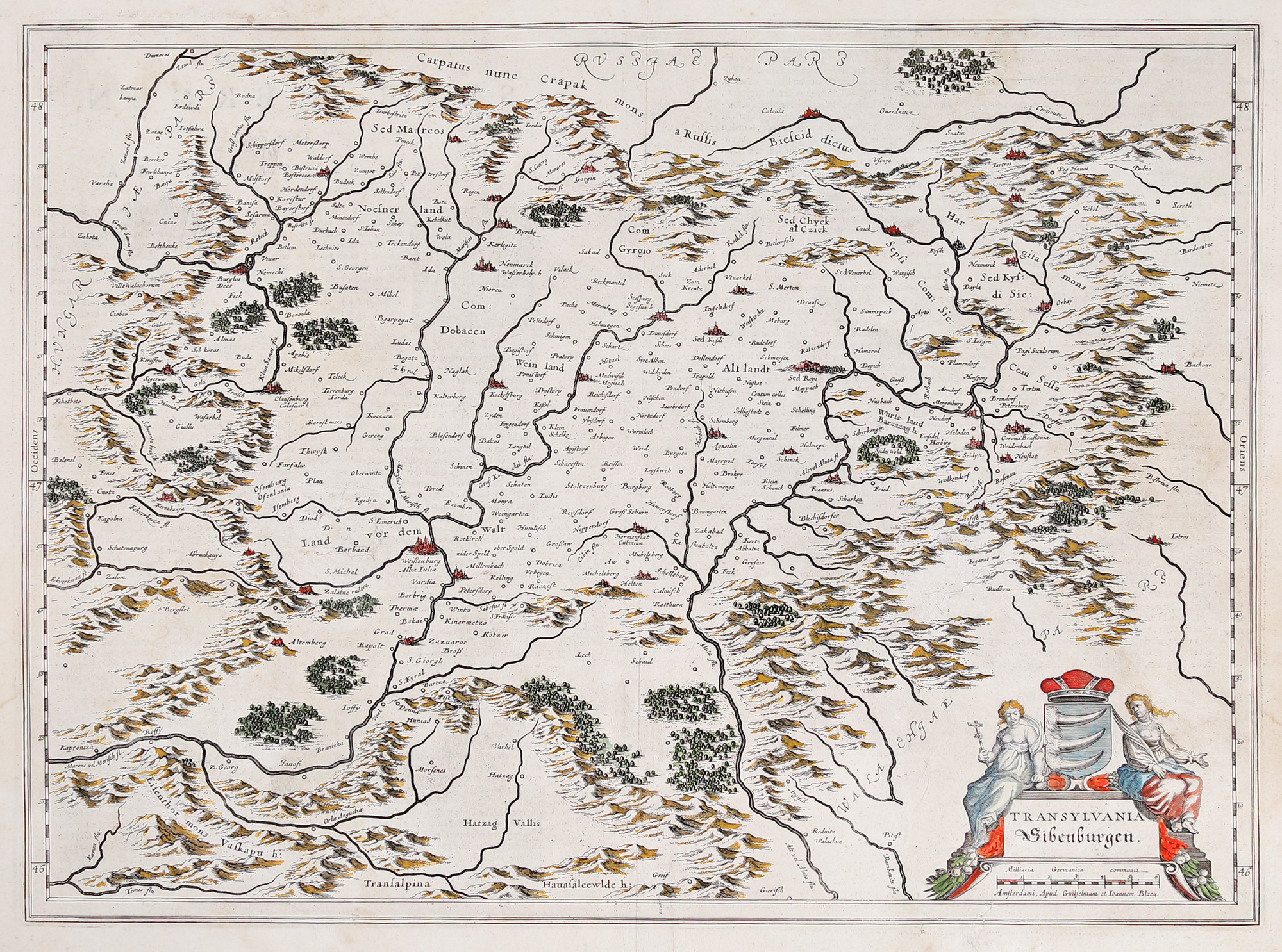
240. "Transylvania" map, by Willem Janszoon Blaeu, Amsterdam, 1636
Начална цена
EUR 250
Продадено
EUR 400
Сесия
Вто, 19 юли 2022 19:00
Размери
width 50 cm, height 38 cm
Описание
copper engraving hand-coloured
Информация от изследване
Novus Atlas Edition
ДОПЪЛНИТЕЛНА ИНФОРМАЦИЯ
За разяснения относно процедурата по наддаване, разходите при спечелване, условията за гаранция, плащане и вземане на спечеления лот, препоръчваме внимателно четене/препрочитане на Правилника за наддаване.
За допълнителна информация относно лота и търга, моля свържете се с Отдела на арт консултантите.
Detalii
ДОПЪЛНИТЕЛНА ИНФОРМАЦИЯ
За разяснения относно процедурата по наддаване, разходите при спечелване, условията за гаранция, плащане и вземане на спечеления лот, препоръчваме внимателно четене/препрочитане на Правилника за наддаване.
За допълнителна информация относно лота и търга, моля свържете се с Отдела на арт консултантите.
Размери
width 50 cm, height 38 cm
Описание
copper engraving hand-coloured
Информация от изследване
Novus Atlas Edition
Алтернативни лотове

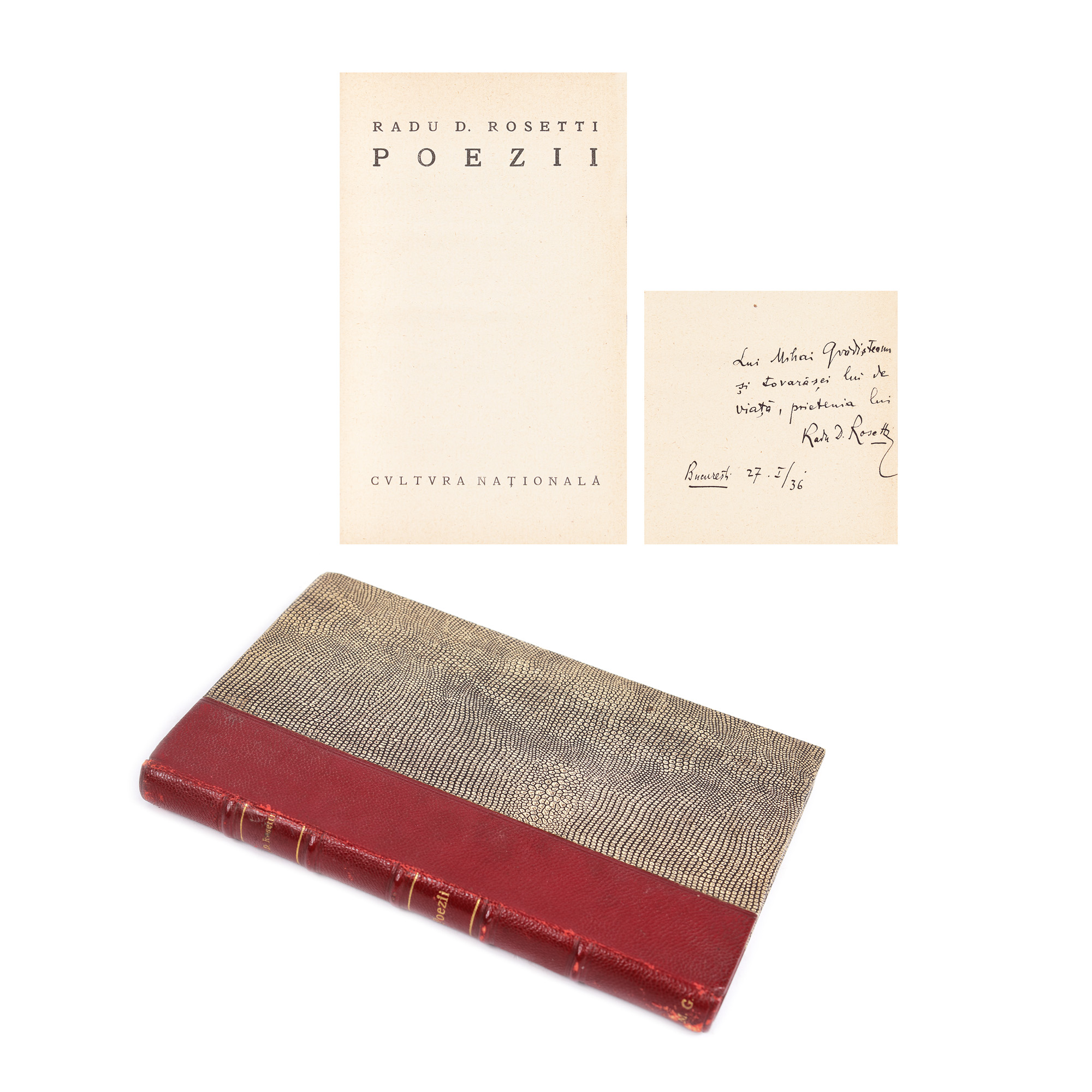
228. "Poezii", by Radu D. Rosetti, Bucharest, 1936, with the author's dedication to Mihail Grădișteanu
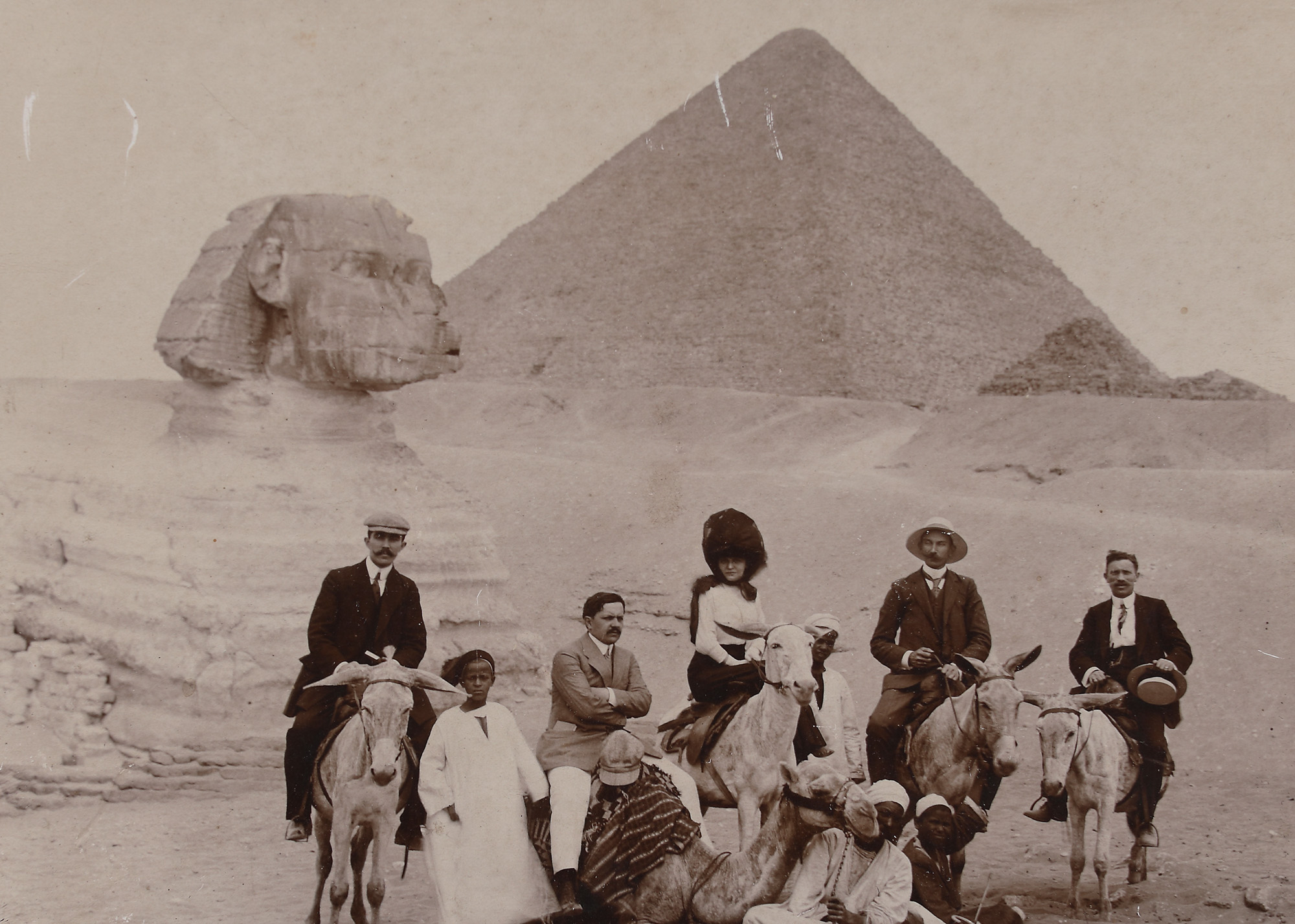
194. Unpublished photograph showing Martha Bibescu visiting Egypt, approx. 1905